About the trail
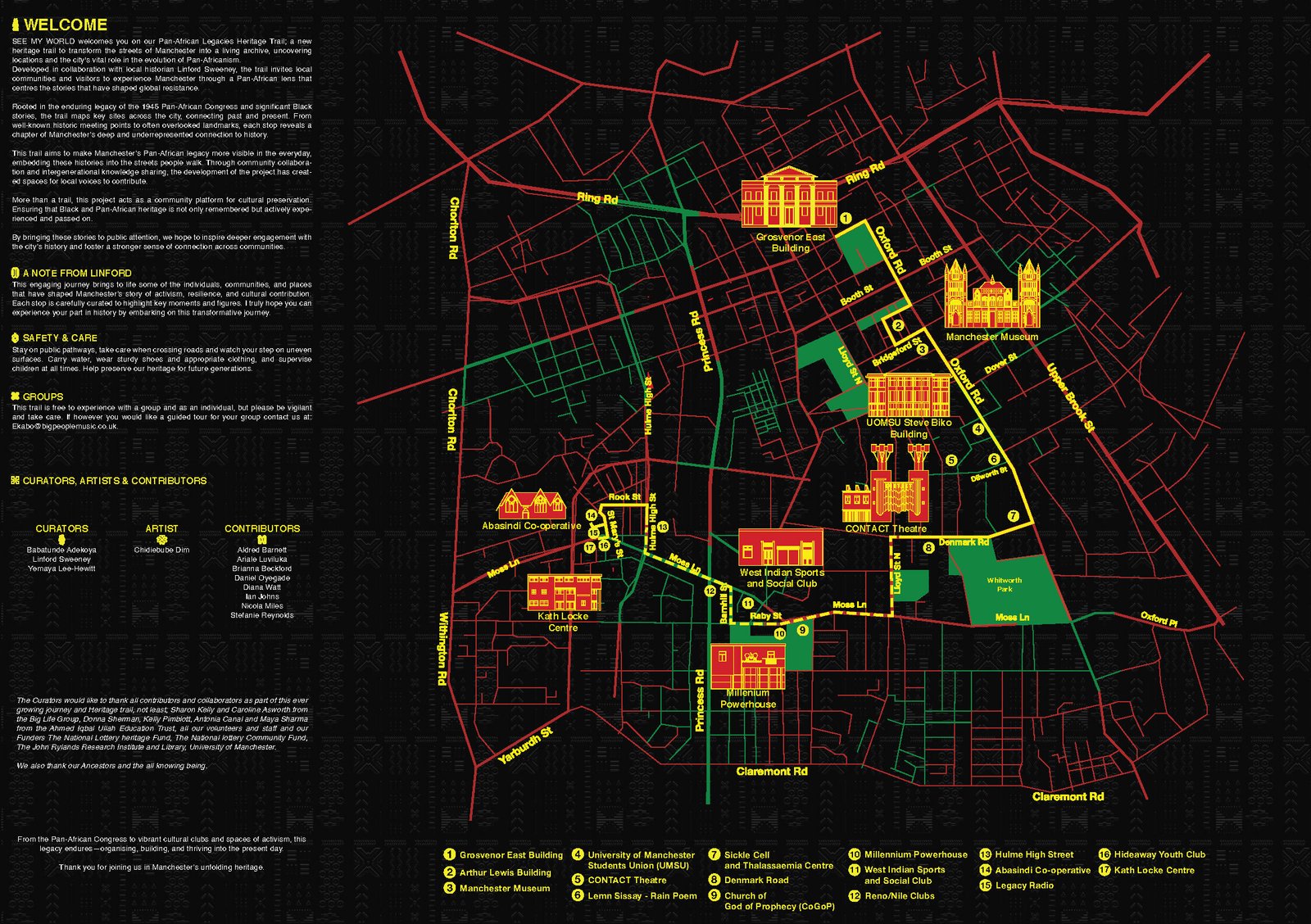
Curated by local historian Linford Sweeney and rooted in the enduring legacy of the 1945 Pan-African Congress, this trail maps key sites across the city, connecting past and present through storytelling, memory, and place. From historic meeting points to overlooked landmarks, each stop reveals a chapter of Manchester's story that too often goes untold.
Created as a one-time hosted walk, the trail now lives on as a public resource. You can follow it at your own pace, whenever you like.
Walking the trail
The trail comes in two parts, each a self-contained walk with its own map. Do one, do the other, or link them together into a single afternoon using the optional connecting walk. Comfortable shoes are a good idea, and so is checking the weather. This is Manchester, after all.
The trail is split into two parts:
Part 1: Down the Oxford Road
Points 1 to 9, beginning at the Fifth Pan-African Congress plaque outside the Grosvenor East Building (M15 6BG).
- Around 2km
- Roughly 45 minutes, self-guided
- Connecting walk (optional, if you want to do both parts in one go) Points 9 to 14, linking the end of Part 1 to the start of Part 2.
- Around 1.7km
- Roughly 30 to 40 minutes
Part 2: Hulme High Street and Moss Side Loop
Points 14 to 17, ending at the Kath Locke Centre (M15 5DD).
- Around 0.5km
- Roughly 15 minutes, self-guided
Download the map and booklet
Everything you need is in the digital booklet: the full map, every stop, and the history behind each one. Use the link at the bottom to download the map and booklet.
This trail is produced by Big People Community CIC and Big People Music. Funded by the National Lottery Heritage Fund, the National Lottery Community Fund and The University of Manchester.